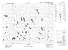
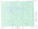
Maps showing Lac Magé, Baie-James; Jamésie, Quebec
Lac Magé is a Lake located in Baie-James; Jamésie, Quebec.
- Latitude: 50° 1' 33'' North (decimal: 50.0258333)
- Longitude: 79° 29' 46'' West (decimal: -79.4961111)
- Topography Feature Category: Lake
- Geographical Feature: Lac
- Canadian Province/Territory: Quebec
- Location: Baie-James; Jamésie
- GPS Coordinate Locator Map: Lac Magé Lat/Long
Lac Magé NTS Map Sheets