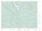
Maps showing Lac de la Main, Lac-au-Brochet; La Haute-Côte-Nord, Quebec
Lac de la Main is a Lake located in Lac-au-Brochet; La Haute-Côte-Nord, Quebec and has an elevation of 427 meters.
- Latitude: 49° 2' 9'' North (decimal: 49.0358655)
- Longitude: 69° 26' 36'' West (decimal: -69.4433898)
- Topography Feature Category: Lake
- Geographical Feature: Lac
- Canadian Province/Territory: Quebec
- Elevation: 427 meters
- Location: Lac-au-Brochet; La Haute-Côte-Nord
- Atlas of Canada Locator Map: Lac de la Main
- GPS Coordinate Locator Map: Lac de la Main Lat/Long
Lac de la Main NTS Map Sheets