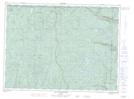
Maps showing Petite rivière Malbaie, Lac-Pikauba; Charlevoix, Quebec
Petite rivière Malbaie is a River located in Lac-Pikauba; Charlevoix, Quebec and has an elevation of 777 meters.
- Latitude: 47° 43' 8'' North (decimal: 47.7188889)
- Longitude: 70° 47' 40'' West (decimal: -70.7944444)
- Topography Feature Category: River
- Geographical Feature: Rivière
- Canadian Province/Territory: Quebec
- Elevation: 777 meters
- Location: Lac-Pikauba; Charlevoix
- Atlas of Canada Locator Map: Petite rivière Malbaie
- GPS Coordinate Locator Map: Petite rivière Malbaie Lat/Long
Petite rivière Malbaie NTS Map Sheets