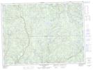
Maps showing Rivière du Mâle Ouest, Lac-Ashuapmushuan; Le Domaine-du-Roy, Quebec
Rivière du Mâle Ouest is a River located in Lac-Ashuapmushuan; Le Domaine-du-Roy, Quebec.
- Latitude: 48° 11' 40'' North (decimal: 48.1944926)
- Longitude: 72° 47' 57'' West (decimal: -72.7992976)
- Topography Feature Category: River
- Geographical Feature: Segment de rivière
- Canadian Province/Territory: Quebec
- Location: Lac-Ashuapmushuan; Le Domaine-du-Roy
- Atlas of Canada Locator Map: Rivière du Mâle Ouest
- GPS Coordinate Locator Map: Rivière du Mâle Ouest Lat/Long
Rivière du Mâle Ouest NTS Map Sheets