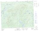
Maps showing Rivière Mamaskwasati, Baie-James; Jamésie, Quebec
Rivière Mamaskwasati is a River located in Baie-James; Jamésie, Quebec.
- Latitude: 51° 53' 40'' North (decimal: 51.8945245)
- Longitude: 72° 59' 33'' West (decimal: -72.9926242)
- Topography Feature Category: River
- Geographical Feature: Rivière
- Canadian Province/Territory: Quebec
- Location: Baie-James; Jamésie
- GPS Coordinate Locator Map: Rivière Mamaskwasati Lat/Long
Rivière Mamaskwasati NTS Map Sheets