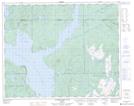
Maps showing Mont Manic, Rivière-Mouchalagane; Caniapiscau, Quebec
Mont Manic is a Mountain located in Rivière-Mouchalagane; Caniapiscau, Quebec and has an elevation of 741 meters.
- Latitude: 51° 35' 45'' North (decimal: 51.5958333)
- Longitude: 68° 15' 49'' West (decimal: -68.2636111)
- Topography Feature Category: Mountain
- Geographical Feature: Mont
- Canadian Province/Territory: Quebec
- Elevation: 741 meters
- Location: Rivière-Mouchalagane; Caniapiscau
- Atlas of Canada Locator Map: Mont Manic
- GPS Coordinate Locator Map: Mont Manic Lat/Long
Mont Manic NTS Map Sheets