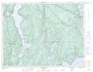
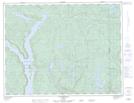
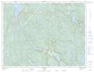
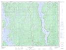
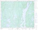
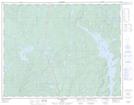
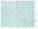
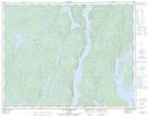
Maps showing Rivière Manicouagan, Baie-Comeau; Manicouagan, Quebec
Rivière Manicouagan is a River located in Baie-Comeau; Manicouagan, Quebec and has an elevation of 30 meters.
- Latitude: 49° 10' 34'' North (decimal: 49.1761569)
- Longitude: 68° 11' 38'' West (decimal: -68.1939162)
- Topography Feature Category: River
- Geographical Feature: Rivière
- Canadian Province/Territory: Quebec
- Elevation: 30 meters
- Location: Baie-Comeau; Manicouagan
- Atlas of Canada Locator Map: Rivière Manicouagan
- GPS Coordinate Locator Map: Rivière Manicouagan Lat/Long
Rivière Manicouagan NTS Map Sheets
022F01 Baie-Comeau Topographic Map at 1:50,000 scale
022F08 Lac Castelnau Topographic Map at 1:50,000 scale
022F09 Lac Miquelon Topographic Map at 1:50,000 scale
022F10 Lac Varin Topographic Map at 1:50,000 scale
022F15 Riviere Vallant Topographic Map at 1:50,000 scale
022K02 Lac Gaillard Topographic Map at 1:50,000 scale
022K07 Lac Okaopeo Topographic Map at 1:50,000 scale
022K10 Lac De La Cache Topographic Map at 1:50,000 scale
022K15 Lac Du Bois Long Topographic Map at 1:50,000 scale
022F Baie-Comeau Topographic Map at 1:250,000 scale
022K Lac Berte Topographic Map at 1:250,000 scale