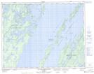
Maps showing Pointe du Manitou, Mistissini; Jamésie, Quebec
Pointe du Manitou is a Cape located in Mistissini; Jamésie, Quebec and has an elevation of 396 meters.
- Latitude: 50° 47' 2'' North (decimal: 50.7838889)
- Longitude: 73° 35' 26'' West (decimal: -73.5905556)
- Topography Feature Category: Cape
- Geographical Feature: Pointe
- Canadian Province/Territory: Quebec
- Elevation: 396 meters
- Location: Mistissini; Jamésie
- Atlas of Canada Locator Map: Pointe du Manitou
- GPS Coordinate Locator Map: Pointe du Manitou Lat/Long
Pointe du Manitou NTS Map Sheets