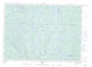
Maps showing Rapides Manitou, Waltham; Pontiac, Quebec
Rapides Manitou is a Rapids located in Waltham; Pontiac, Quebec and has an elevation of 199 meters.
- Latitude: 46° 5' 50'' North (decimal: 46.0972792)
- Longitude: 76° 58' 55'' West (decimal: -76.9819447)
- Topography Feature Category: Rapids
- Geographical Feature: Rapides
- Canadian Province/Territory: Quebec
- Elevation: 199 meters
- Location: Waltham; Pontiac
- Atlas of Canada Locator Map: Rapides Manitou
- GPS Coordinate Locator Map: Rapides Manitou Lat/Long
Rapides Manitou NTS Map Sheets