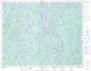
Maps showing Lac Marie-Ange, Rivière-aux-Outardes; Manicouagan, Quebec
Lac Marie-Ange is a Bay located in Rivière-aux-Outardes; Manicouagan, Quebec.
- Latitude: 50° 36' 46'' North (decimal: 50.6127910)
- Longitude: 68° 38' 32'' West (decimal: -68.6423098)
- Topography Feature Category: Bay
- Geographical Feature: Baie
- Canadian Province/Territory: Quebec
- Location: Rivière-aux-Outardes; Manicouagan
- GPS Coordinate Locator Map: Lac Marie-Ange Lat/Long
Lac Marie-Ange NTS Map Sheets