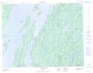
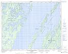
Maps showing Île Marie-Victorin, Baie-James; Jamésie, Quebec
Île Marie-Victorin is a Island located in Baie-James; Jamésie, Quebec and has an elevation of 396 meters.
- Latitude: 50° 46' 43'' North (decimal: 50.7786111)
- Longitude: 73° 44' 59'' West (decimal: -73.7497222)
- Topography Feature Category: Island
- Geographical Feature: Île / Ile
- Canadian Province/Territory: Quebec
- Elevation: 396 meters
- Location: Baie-James; Jamésie
- Atlas of Canada Locator Map: Île Marie-Victorin
- GPS Coordinate Locator Map: Île Marie-Victorin Lat/Long
Île Marie-Victorin NTS Map Sheets