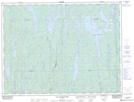
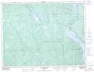
Maps showing Rivière Marquette Ouest, Lac-Ashuapmushuan; LeDomaine-du-Roy, Quebec
Rivière Marquette Ouest is a River located in Lac-Ashuapmushuan; LeDomaine-du-Roy, Quebec and has an elevation of 389 meters.
- Latitude: 49° 9' 14'' North (decimal: 49.1539513)
- Longitude: 73° 54' 58'' West (decimal: -73.9162231)
- Topography Feature Category: River
- Geographical Feature: Rivière
- Canadian Province/Territory: Quebec
- Elevation: 389 meters
- Location: Lac-Ashuapmushuan; LeDomaine-du-Roy
- Atlas of Canada Locator Map: Rivière Marquette Ouest
- GPS Coordinate Locator Map: Rivière Marquette Ouest Lat/Long
Rivière Marquette Ouest NTS Map Sheets