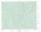
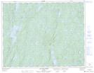
Maps showing Rivière à la Marte, Rivière-aux-Outardes; Manicouagan, Quebec
Rivière à la Marte is a River located in Rivière-aux-Outardes; Manicouagan, Quebec.
- Latitude: 49° 59' 31'' North (decimal: 49.9919444)
- Longitude: 68° 27' 38'' West (decimal: -68.4605556)
- Topography Feature Category: River
- Geographical Feature: Rivière
- Canadian Province/Territory: Quebec
- Location: Rivière-aux-Outardes; Manicouagan
- GPS Coordinate Locator Map: Rivière à la Marte Lat/Long
Rivière à la Marte NTS Map Sheets