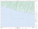
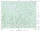
Maps showing Ruisseau Martin, L'Île-d'Anticosti; Minganie, Quebec
Ruisseau Martin is a River located in L'Île-d'Anticosti; Minganie, Quebec and has an elevation of 71 meters.
- Latitude: 49° 9' 54'' North (decimal: 49.1650714)
- Longitude: 62° 47' 36'' West (decimal: -62.7934564)
- Topography Feature Category: River
- Geographical Feature: Ruisseau
- Canadian Province/Territory: Quebec
- Elevation: 71 meters
- Location: L'Île-d'Anticosti; Minganie
- Atlas of Canada Locator Map: Ruisseau Martin
- GPS Coordinate Locator Map: Ruisseau Martin Lat/Long
Ruisseau Martin NTS Map Sheets