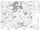
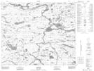
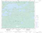
Maps showing Chenal Masta, Baie-James; Jamésie, Quebec
Chenal Masta is a Channel located in Baie-James; Jamésie, Quebec and has an elevation of 304 meters.
- Latitude: 53° 17' 59'' North (decimal: 53.2997222)
- Longitude: 74° 37' 47'' West (decimal: -74.6297222)
- Topography Feature Category: Channel
- Geographical Feature: Chenal
- Canadian Province/Territory: Quebec
- Elevation: 304 meters
- Location: Baie-James; Jamésie
- Atlas of Canada Locator Map: Chenal Masta
- GPS Coordinate Locator Map: Chenal Masta Lat/Long
Chenal Masta NTS Map Sheets