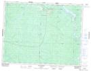
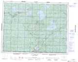
Maps showing Matagami-Station, Baie-James; Jamésie, Quebec
Matagami-Station is a Unincorporated area located in Baie-James; Jamésie, Quebec and has an elevation of 285 meters.
- Latitude: 49° 43' 44'' North (decimal: 49.7288889)
- Longitude: 77° 42' 19'' West (decimal: -77.7052778)
- Topography Feature Category: Unincorporated area
- Geographical Feature: Arrêt ferroviaire
- Canadian Province/Territory: Quebec
- Elevation: 285 meters
- Location: Baie-James; Jamésie
- Atlas of Canada Locator Map: Matagami-Station
- GPS Coordinate Locator Map: Matagami-Station Lat/Long
Matagami-Station NTS Map Sheets