Canada Topographic Maps

Rivière Matawin Topo Maps

Topography maps and Latitude/Longitude Location

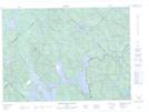
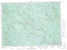
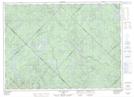
Maps showing Rivière Matawin, Shawinigan; Shawinigan, Quebec

Rivière Matawin is a River located in Shawinigan; Shawinigan, Quebec and has an elevation of 215 meters.

  • Latitude: 46° 54' 11'' North   (decimal: 46.9030868)
  • Longitude: 72° 55' 58'' West   (decimal: -72.9328993)
  • Topography Feature Category: River
  • Geographical Feature: Rivière
  • Canadian Province/Territory: Quebec
  • Elevation: 215 meters
  • Location: Shawinigan; Shawinigan
  • Atlas of Canada Locator Map: Rivière Matawin
  • GPS Coordinate Locator Map: Rivière Matawin Lat/Long

Rivière Matawin NTS Map Sheets

031I12 Saint-Michel-Des-Saints Topographic Map at 1:50,000 scale

031I13 Reservoir Taureau Topographic Map at 1:50,000 scale

031I14 Lac Eveline Topographic Map at 1:50,000 scale

031I15 Riviere-Mekinac Topographic Map at 1:50,000 scale

031J09 Saint-Guillaume-Nord Topographic Map at 1:50,000 scale

031J16 Lac Charland Topographic Map at 1:50,000 scale

031I Trois-Rivieres Topographic Map at 1:250,000 scale

031J Mont-Laurier Topographic Map at 1:250,000 scale

 
Buy Topographic Maps DVD
Newsletter Sign-up

Yes, I want to receive map store discounts.


Bookmark and Share