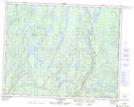
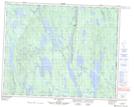
Maps showing Rivière Matinipi, Rivière-Nipissis; Sept-Rivières, Quebec
Rivière Matinipi is a River located in Rivière-Nipissis; Sept-Rivières, Quebec and has an elevation of 567 meters.
- Latitude: 51° 23' 30'' North (decimal: 51.3917212)
- Longitude: 65° 53' 17'' West (decimal: -65.8879769)
- Topography Feature Category: River
- Geographical Feature: Rivière
- Canadian Province/Territory: Quebec
- Elevation: 567 meters
- Location: Rivière-Nipissis; Sept-Rivières
- Atlas of Canada Locator Map: Rivière Matinipi
- GPS Coordinate Locator Map: Rivière Matinipi Lat/Long
Rivière Matinipi NTS Map Sheets