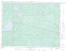
Maps showing Lac Mattawa, Mont-Valin; Le Fjord-du-Saguenay, Quebec
Lac Mattawa is a Lake located in Mont-Valin; Le Fjord-du-Saguenay, Quebec.
- Latitude: 49° 2' 3'' North (decimal: 49.0341667)
- Longitude: 70° 30' 4'' West (decimal: -70.5011111)
- Topography Feature Category: Lake
- Geographical Feature: Lac
- Canadian Province/Territory: Quebec
- Location: Mont-Valin; Le Fjord-du-Saguenay
- GPS Coordinate Locator Map: Lac Mattawa Lat/Long
Lac Mattawa NTS Map Sheets
022D16 Lac Poulin-De-Courval Topographic Map at 1:50,000 scale
022E01 Lac Portneuf Topographic Map at 1:50,000 scale
022E02 Lac Maria-Chapdelaine Topographic Map at 1:50,000 scale
022D Chicoutimi Topographic Map at 1:250,000 scale
022E Reservoir Pipmuacan Topographic Map at 1:250,000 scale
022E01 Lac Portneuf Topographic Map at 1:50,000 scale
022E02 Lac Maria-Chapdelaine Topographic Map at 1:50,000 scale
022D Chicoutimi Topographic Map at 1:250,000 scale
022E Reservoir Pipmuacan Topographic Map at 1:250,000 scale