Canada Topographic Maps

Rivière Maugé Topo Maps

Topography maps and Latitude/Longitude Location

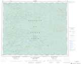
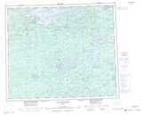
Maps showing Rivière Maugé, Baie-James; Jamésie, Quebec

Rivière Maugé is a River located in Baie-James; Jamésie, Quebec.

  • Latitude: 53° 1' 54'' North   (decimal: 53.0316667)
  • Longitude: 73° 38' 51'' West   (decimal: -73.6475)
  • Topography Feature Category: River
  • Geographical Feature: Rivière
  • Canadian Province/Territory: Quebec
  • Location: Baie-James; Jamésie
  • Atlas of Canada Locator Map: Rivière Maugé
  • GPS Coordinate Locator Map: Rivière Maugé Lat/Long

Rivière Maugé NTS Map Sheets

033A13 Lac Lanfranc Topographic Map at 1:50,000 scale

033B16 Lac Philibert Topographic Map at 1:50,000 scale

033H04 Lac Pelletan Topographic Map at 1:50,000 scale

033A Lac Rossignol Topographic Map at 1:250,000 scale

033B Lac Lichteneger Topographic Map at 1:250,000 scale

033H Lac Sauvolles Topographic Map at 1:250,000 scale

 
Buy Topographic Maps DVD
Newsletter Sign-up

Yes, I want to receive map store discounts.


Bookmark and Share