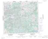
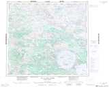
Maps showing Lac Maulnier, Baie-d'Hudson; Kativik, Quebec
Lac Maulnier is a Lake located in Baie-d'Hudson; Kativik, Quebec.
- Latitude: 56° 36' 53'' North (decimal: 56.6146143)
- Longitude: 73° 59' 23'' West (decimal: -73.9898370)
- Topography Feature Category: Lake
- Geographical Feature: Lac
- Canadian Province/Territory: Quebec
- Location: Baie-d'Hudson; Kativik
- Atlas of Canada Locator Map: Lac Maulnier
- GPS Coordinate Locator Map: Lac Maulnier Lat/Long
Lac Maulnier NTS Map Sheets