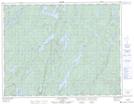
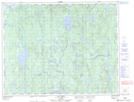
Maps showing Lac Mauvais Bois, Rivière-aux-Outardes; Manicouagan, Quebec
Lac Mauvais Bois is a Lake located in Rivière-aux-Outardes; Manicouagan, Quebec and has an elevation of 395 meters.
- Latitude: 50° 28' 31'' North (decimal: 50.4752778)
- Longitude: 68° 18' 19'' West (decimal: -68.3052778)
- Topography Feature Category: Lake
- Geographical Feature: Lac
- Canadian Province/Territory: Quebec
- Elevation: 395 meters
- Location: Rivière-aux-Outardes; Manicouagan
- Atlas of Canada Locator Map: Lac Mauvais Bois
- GPS Coordinate Locator Map: Lac Mauvais Bois Lat/Long
Lac Mauvais Bois NTS Map Sheets