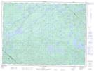
Maps showing Ruisseau May, Senneterre; Vallée-de-l'Or, Quebec
Ruisseau May is a River located in Senneterre; Vallée-de-l'Or, Quebec and has an elevation of 375 meters.
- Latitude: 47° 36' 14'' North (decimal: 47.6039670)
- Longitude: 76° 27' 31'' West (decimal: -76.4585613)
- Topography Feature Category: River
- Geographical Feature: Ruisseau
- Canadian Province/Territory: Quebec
- Elevation: 375 meters
- Location: Senneterre; Vallée-de-l'Or
- Atlas of Canada Locator Map: Ruisseau May
- GPS Coordinate Locator Map: Ruisseau May Lat/Long
Ruisseau May NTS Map Sheets