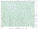
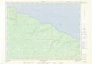
Maps showing Rivière Mazerolle, L'Île-d'Anticosti; Minganie, Quebec
Rivière Mazerolle is a River located in L'Île-d'Anticosti; Minganie, Quebec.
- Latitude: 49° 36' 49'' North (decimal: 49.6136111)
- Longitude: 62° 35' 38'' West (decimal: -62.5938889)
- Topography Feature Category: River
- Geographical Feature: Rivière
- Canadian Province/Territory: Quebec
- Location: L'Île-d'Anticosti; Minganie
- GPS Coordinate Locator Map: Rivière Mazerolle Lat/Long
Rivière Mazerolle NTS Map Sheets