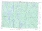
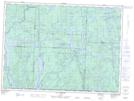
Maps showing Ruisseau McConnel, Lac-Nilgaut; Pontiac, Quebec
Ruisseau McConnel is a River located in Lac-Nilgaut; Pontiac, Quebec.
- Latitude: 47° 6' 19'' North (decimal: 47.1053421)
- Longitude: 77° 41' 29'' West (decimal: -77.6914090)
- Topography Feature Category: River
- Geographical Feature: Ruisseau
- Canadian Province/Territory: Quebec
- Location: Lac-Nilgaut; Pontiac
- GPS Coordinate Locator Map: Ruisseau McConnel Lat/Long
Ruisseau McConnel NTS Map Sheets