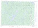
Maps showing Baie Mercier, Cascades-Malignes; La Vallée-de-la-Gatineau, Quebec
Baie Mercier is a Bay located in Cascades-Malignes; La Vallée-de-la-Gatineau, Quebec and has an elevation of 198 meters.
- Latitude: 46° 46' 47'' North (decimal: 46.7797222)
- Longitude: 75° 57' 35'' West (decimal: -75.9597222)
- Topography Feature Category: Bay
- Geographical Feature: Baie
- Canadian Province/Territory: Quebec
- Elevation: 198 meters
- Location: Cascades-Malignes; La Vallée-de-la-Gatineau
- Atlas of Canada Locator Map: Baie Mercier
- GPS Coordinate Locator Map: Baie Mercier Lat/Long
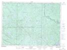
Baie Mercier NTS Map Sheets