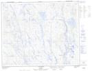
Maps showing Mont Merry, Rivière-Mouchalagane; Caniapiscau, Quebec
Mont Merry is a Mountain located in Rivière-Mouchalagane; Caniapiscau, Quebec and has an elevation of 808 meters.
- Latitude: 52° 24' 48'' North (decimal: 52.4133333)
- Longitude: 67° 57' 36'' West (decimal: -67.96)
- Topography Feature Category: Mountain
- Geographical Feature: Mont
- Canadian Province/Territory: Quebec
- Elevation: 808 meters
- Location: Rivière-Mouchalagane; Caniapiscau
- Atlas of Canada Locator Map: Mont Merry
- GPS Coordinate Locator Map: Mont Merry Lat/Long
Mont Merry NTS Map Sheets