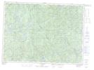
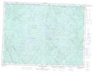
Maps showing Rivière Métascouac, Lac-Croche; La Jacques-Cartier, Quebec
Rivière Métascouac is a River located in Lac-Croche; La Jacques-Cartier, Quebec and has an elevation of 462 meters.
- Latitude: 47° 40' 29'' North (decimal: 47.6747598)
- Longitude: 71° 50' 16'' West (decimal: -71.8378706)
- Topography Feature Category: River
- Geographical Feature: Rivière
- Canadian Province/Territory: Quebec
- Elevation: 462 meters
- Location: Lac-Croche; La Jacques-Cartier
- Atlas of Canada Locator Map: Rivière Métascouac
- GPS Coordinate Locator Map: Rivière Métascouac Lat/Long
Rivière Métascouac NTS Map Sheets