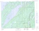
Maps showing Presqu'île Michel-Laure, Baie-James; Jamésie, Quebec
Presqu'île Michel-Laure is a Cape located in Baie-James; Jamésie, Quebec.
- Latitude: 50° 59' 25'' North (decimal: 50.9902778)
- Longitude: 73° 8' 48'' West (decimal: -73.1466667)
- Topography Feature Category: Cape
- Geographical Feature: Presqu'île
- Canadian Province/Territory: Quebec
- Location: Baie-James; Jamésie
- Atlas of Canada Locator Map: Presqu'île Michel-Laure
- GPS Coordinate Locator Map: Presqu'île Michel-Laure Lat/Long
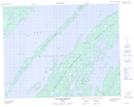
Presqu'île Michel-Laure NTS Map Sheets