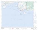
Maps showing Middle Ledges, Bonne-Espérance; Basse-Côte-Nord, Quebec
Middle Ledges is a Shoal located in Bonne-Espérance; Basse-Côte-Nord, Quebec and has an elevation of 0 meters.
- Latitude: 51° 25' 47'' North (decimal: 51.4297759)
- Longitude: 57° 28' 6'' West (decimal: -57.4682390)
- Topography Feature Category: Shoal
- Geographical Feature: Brisants
- Canadian Province/Territory: Quebec
- Elevation: 0 meters
- Location: Bonne-Espérance; Basse-Côte-Nord
- Atlas of Canada Locator Map: Middle Ledges
- GPS Coordinate Locator Map: Middle Ledges Lat/Long
Middle Ledges NTS Map Sheets