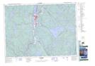
Maps showing Rivière du Milieu, Lac-Masketsi; Mékinac, Quebec
Rivière du Milieu is a River located in Lac-Masketsi; Mékinac, Quebec and has an elevation of 340 meters.
- Latitude: 47° 7' 43'' North (decimal: 47.1286421)
- Longitude: 72° 36' 54'' West (decimal: -72.6151092)
- Topography Feature Category: River
- Geographical Feature: Rivière
- Canadian Province/Territory: Quebec
- Elevation: 340 meters
- Location: Lac-Masketsi; Mékinac
- Atlas of Canada Locator Map: Rivière du Milieu
- GPS Coordinate Locator Map: Rivière du Milieu Lat/Long
Rivière du Milieu NTS Map Sheets