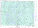
Maps showing Ruisseau Miller, Lac-Marguerite; Antoine-Labelle, Quebec
Ruisseau Miller is a River located in Lac-Marguerite; Antoine-Labelle, Quebec.
- Latitude: 47° 3' 49'' North (decimal: 47.0636738)
- Longitude: 75° 59' 45'' West (decimal: -75.9957682)
- Topography Feature Category: River
- Geographical Feature: Ruisseau
- Canadian Province/Territory: Quebec
- Location: Lac-Marguerite; Antoine-Labelle
- GPS Coordinate Locator Map: Ruisseau Miller Lat/Long
Ruisseau Miller NTS Map Sheets