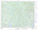
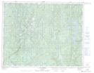
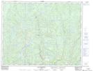
Maps showing Rivière Mingan Nord-Ouest, Lac-Jérôme; Minganie, Quebec
Rivière Mingan Nord-Ouest is a River located in Lac-Jérôme; Minganie, Quebec and has an elevation of 432 meters.
- Latitude: 50° 42' 17'' North (decimal: 50.7047222)
- Longitude: 63° 38' 27'' West (decimal: -63.6408333)
- Topography Feature Category: River
- Geographical Feature: Rivière
- Canadian Province/Territory: Quebec
- Elevation: 432 meters
- Location: Lac-Jérôme; Minganie
- Atlas of Canada Locator Map: Rivière Mingan Nord-Ouest
- GPS Coordinate Locator Map: Rivière Mingan Nord-Ouest Lat/Long
Rivière Mingan Nord-Ouest NTS Map Sheets