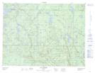
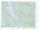
Maps showing Lac Mins, Lac-au-Brochet; La Haute-Côte-Nord, Quebec
Lac Mins is a Lake located in Lac-au-Brochet; La Haute-Côte-Nord, Quebec and has an elevation of 459 meters.
- Latitude: 49° 14' 43'' North (decimal: 49.2453164)
- Longitude: 69° 51' 4'' West (decimal: -69.8511903)
- Topography Feature Category: Lake
- Geographical Feature: Lac
- Canadian Province/Territory: Quebec
- Elevation: 459 meters
- Location: Lac-au-Brochet; La Haute-Côte-Nord
- Atlas of Canada Locator Map: Lac Mins
- GPS Coordinate Locator Map: Lac Mins Lat/Long
Lac Mins NTS Map Sheets