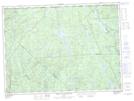
Maps showing Étang Misère, La Tuque; Le Haut-Saint-Maurice, Quebec
Étang Misère is a Lake located in La Tuque; Le Haut-Saint-Maurice, Quebec.
- Latitude: 47° 45' 19'' North (decimal: 47.7552777)
- Longitude: 72° 28' 35'' West (decimal: -72.4763889)
- Topography Feature Category: Lake
- Geographical Feature: Étang
- Canadian Province/Territory: Quebec
- Location: La Tuque; Le Haut-Saint-Maurice
- Atlas of Canada Locator Map: Étang Misère
- GPS Coordinate Locator Map: Étang Misère Lat/Long
Étang Misère NTS Map Sheets