Maps showing Rivière Mitirtuup Kuunga, Baie-d'Hudson; Kativik, Quebec
Rivière Mitirtuup Kuunga is a River located in Baie-d'Hudson; Kativik, Quebec.
- Latitude: 55° 38' 45'' North (decimal: 55.6458333)
- Longitude: 77° 9' 48'' West (decimal: -77.1633333)
- Topography Feature Category: River
- Geographical Feature: Rivière
- Canadian Province/Territory: Quebec
- Location: Baie-d'Hudson; Kativik
- Atlas of Canada Locator Map: Rivière Mitirtuup Kuunga
- GPS Coordinate Locator Map: Rivière Mitirtuup Kuunga Lat/Long
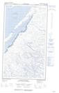
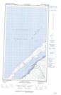
Rivière Mitirtuup Kuunga NTS Map Sheets