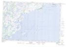
Maps showing Rocher Montcalm, Côte-Nord-du-Golfe-du-Saint-Laurent; Basse-Côte-Nord, Quebec
Rocher Montcalm is a Island located in Côte-Nord-du-Golfe-du-Saint-Laurent; Basse-Côte-Nord, Quebec.
- Latitude: 50° 20' 55'' North (decimal: 50.3486111)
- Longitude: 59° 45' 30'' West (decimal: -59.7583333)
- Topography Feature Category: Island
- Geographical Feature: Rocher
- Canadian Province/Territory: Quebec
- Location: Côte-Nord-du-Golfe-du-Saint-Laurent; Basse-Côte-Nord
- Atlas of Canada Locator Map: Rocher Montcalm
- GPS Coordinate Locator Map: Rocher Montcalm Lat/Long
Rocher Montcalm NTS Map Sheets