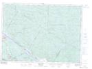
Maps showing Moose Pond, Lac-Nilgaut; Pontiac, Quebec
Moose Pond is a Lake located in Lac-Nilgaut; Pontiac, Quebec.
- Latitude: 46° 10' 21'' North (decimal: 46.1725)
- Longitude: 77° 12' 8'' West (decimal: -77.2022222)
- Topography Feature Category: Lake
- Geographical Feature: Étang
- Canadian Province/Territory: Quebec
- Location: Lac-Nilgaut; Pontiac
- GPS Coordinate Locator Map: Moose Pond Lat/Long
Moose Pond NTS Map Sheets