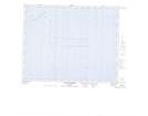
Maps showing Récifs Murr, Gros-Mécatina; Basse-Côte-Nord, Quebec
Récifs Murr is a Shoal located in Gros-Mécatina; Basse-Côte-Nord, Quebec.
- Latitude: 50° 43' 5'' North (decimal: 50.7180556)
- Longitude: 58° 51' 3'' West (decimal: -58.8508333)
- Topography Feature Category: Shoal
- Geographical Feature: Récifs
- Canadian Province/Territory: Quebec
- Location: Gros-Mécatina; Basse-Côte-Nord
- GPS Coordinate Locator Map: Récifs Murr Lat/Long
Récifs Murr NTS Map Sheets