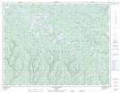
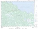
Maps showing Rivière Natiscotec, L'Île-d'Anticosti; Minganie, Quebec
Rivière Natiscotec is a River located in L'Île-d'Anticosti; Minganie, Quebec and has an elevation of 82 meters.
- Latitude: 49° 30' 3'' North (decimal: 49.5009112)
- Longitude: 62° 25' 14'' West (decimal: -62.4206722)
- Topography Feature Category: River
- Geographical Feature: Rivière
- Canadian Province/Territory: Quebec
- Elevation: 82 meters
- Location: L'Île-d'Anticosti; Minganie
- Atlas of Canada Locator Map: Rivière Natiscotec
- GPS Coordinate Locator Map: Rivière Natiscotec Lat/Long
Rivière Natiscotec NTS Map Sheets