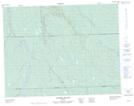
Maps showing Lac Neigebaver, Baie-James; Jamésie, Quebec
Lac Neigebaver is a Lake located in Baie-James; Jamésie, Quebec.
- Latitude: 50° 4' 51'' North (decimal: 50.0807999)
- Longitude: 78° 30' 43'' West (decimal: -78.5118999)
- Topography Feature Category: Lake
- Geographical Feature: Lac
- Canadian Province/Territory: Quebec
- Location: Baie-James; Jamésie
- GPS Coordinate Locator Map: Lac Neigebaver Lat/Long
Lac Neigebaver NTS Map Sheets