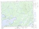
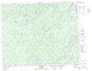
Maps showing Rivière Neilson, Baie-James; Jamésie, Quebec
Rivière Neilson is a River located in Baie-James; Jamésie, Quebec and has an elevation of 556 meters.
- Latitude: 51° 24' 34'' North (decimal: 51.4094444)
- Longitude: 72° 58' 46'' West (decimal: -72.9794444)
- Topography Feature Category: River
- Geographical Feature: Rivière
- Canadian Province/Territory: Quebec
- Elevation: 556 meters
- Location: Baie-James; Jamésie
- Atlas of Canada Locator Map: Rivière Neilson
- GPS Coordinate Locator Map: Rivière Neilson Lat/Long
Rivière Neilson NTS Map Sheets