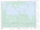
Maps showing Baie Nepawa, Clerval; Abitibi-Ouest, Quebec
Baie Nepawa is a Bay located in Clerval; Abitibi-Ouest, Quebec and has an elevation of 271 meters.
- Latitude: 48° 43' 45'' North (decimal: 48.7291666)
- Longitude: 79° 28' 56'' West (decimal: -79.4822222)
- Topography Feature Category: Bay
- Geographical Feature: Baie
- Canadian Province/Territory: Quebec
- Elevation: 271 meters
- Location: Clerval; Abitibi-Ouest
- Atlas of Canada Locator Map: Baie Nepawa
- GPS Coordinate Locator Map: Baie Nepawa Lat/Long
Baie Nepawa NTS Map Sheets