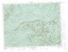
Maps showing Mont Noble, Rivière-Bonjour; Matane, Quebec
Mont Noble is a Mountain located in Rivière-Bonjour; Matane, Quebec and has an elevation of 515 meters.
- Latitude: 48° 38' 54'' North (decimal: 48.6483333)
- Longitude: 66° 12' 20'' West (decimal: -66.2055555)
- Topography Feature Category: Mountain
- Geographical Feature: Mont
- Canadian Province/Territory: Quebec
- Elevation: 515 meters
- Location: Rivière-Bonjour; Matane
- Atlas of Canada Locator Map: Mont Noble
- GPS Coordinate Locator Map: Mont Noble Lat/Long