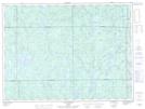
Maps showing Ruisseau Noran, La Tuque; Le Haut-Saint-Maurice, Quebec
Ruisseau Noran is a River located in La Tuque; Le Haut-Saint-Maurice, Quebec.
- Latitude: 48° 4' 12'' North (decimal: 48.0700621)
- Longitude: 74° 7' 6'' West (decimal: -74.1184573)
- Topography Feature Category: River
- Geographical Feature: Ruisseau
- Canadian Province/Territory: Quebec
- Location: La Tuque; Le Haut-Saint-Maurice
- GPS Coordinate Locator Map: Ruisseau Noran Lat/Long
Ruisseau Noran NTS Map Sheets