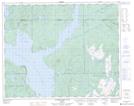
Maps showing Baie du Nord, Rivière-Mouchalagane; Caniapiscau, Quebec
Baie du Nord is a Bay located in Rivière-Mouchalagane; Caniapiscau, Quebec and has an elevation of 354 meters.
- Latitude: 51° 39' 29'' North (decimal: 51.6580556)
- Longitude: 68° 25' 1'' West (decimal: -68.4169444)
- Topography Feature Category: Bay
- Geographical Feature: Baie
- Canadian Province/Territory: Quebec
- Elevation: 354 meters
- Location: Rivière-Mouchalagane; Caniapiscau
- Atlas of Canada Locator Map: Baie du Nord
- GPS Coordinate Locator Map: Baie du Nord Lat/Long
Baie du Nord NTS Map Sheets