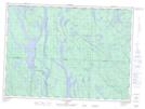
Maps showing Rivière du Nord, Lac-Nilgaut; Pontiac, Quebec
Rivière du Nord is a River located in Lac-Nilgaut; Pontiac, Quebec and has an elevation of 318 meters.
- Latitude: 46° 48' 54'' North (decimal: 46.8150578)
- Longitude: 77° 49' 22'' West (decimal: -77.8228056)
- Topography Feature Category: River
- Geographical Feature: Rivière
- Canadian Province/Territory: Quebec
- Elevation: 318 meters
- Location: Lac-Nilgaut; Pontiac
- Atlas of Canada Locator Map: Rivière du Nord
- GPS Coordinate Locator Map: Rivière du Nord Lat/Long
Rivière du Nord NTS Map Sheets