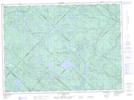
Maps showing Rivière North Branch, La Tuque; Le Haut-Saint-Maurice, Quebec
Rivière North Branch is a River located in La Tuque; Le Haut-Saint-Maurice, Quebec.
- Latitude: 47° 11' 1'' North (decimal: 47.1836467)
- Longitude: 72° 59' 1'' West (decimal: -72.9837302)
- Topography Feature Category: River
- Geographical Feature: Rivière
- Canadian Province/Territory: Quebec
- Location: La Tuque; Le Haut-Saint-Maurice
- GPS Coordinate Locator Map: Rivière North Branch Lat/Long
Rivière North Branch NTS Map Sheets