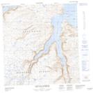
Maps showing Mont Obs, Rivière-Koksoak; Kativik, Quebec
Mont Obs is a Mountain located in Rivière-Koksoak; Kativik, Quebec.
- Latitude: 61° 55' 5'' North (decimal: 61.9180494)
- Longitude: 72° 36' 22'' West (decimal: -72.6061325)
- Topography Feature Category: Mountain
- Geographical Feature: Mont
- Canadian Province/Territory: Quebec
- Location: Rivière-Koksoak; Kativik
- Atlas of Canada Locator Map: Mont Obs
- GPS Coordinate Locator Map: Mont Obs Lat/Long
Mont Obs NTS Map Sheets