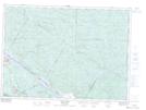
Maps showing Ruisseau à l'Oiseau, Sheenboro; Pontiac, Quebec
Ruisseau à l'Oiseau is a River located in Sheenboro; Pontiac, Quebec and has an elevation of 188 meters.
- Latitude: 46° 2' 48'' North (decimal: 46.0467259)
- Longitude: 77° 19' 12'' West (decimal: -77.3200139)
- Topography Feature Category: River
- Geographical Feature: Ruisseau
- Canadian Province/Territory: Quebec
- Elevation: 188 meters
- Location: Sheenboro; Pontiac
- Atlas of Canada Locator Map: Ruisseau à l'Oiseau
- GPS Coordinate Locator Map: Ruisseau à l'Oiseau Lat/Long
Ruisseau à l'Oiseau NTS Map Sheets